LA Metro’s D Line Subway Extension map | Book Interior Page Layout Spread
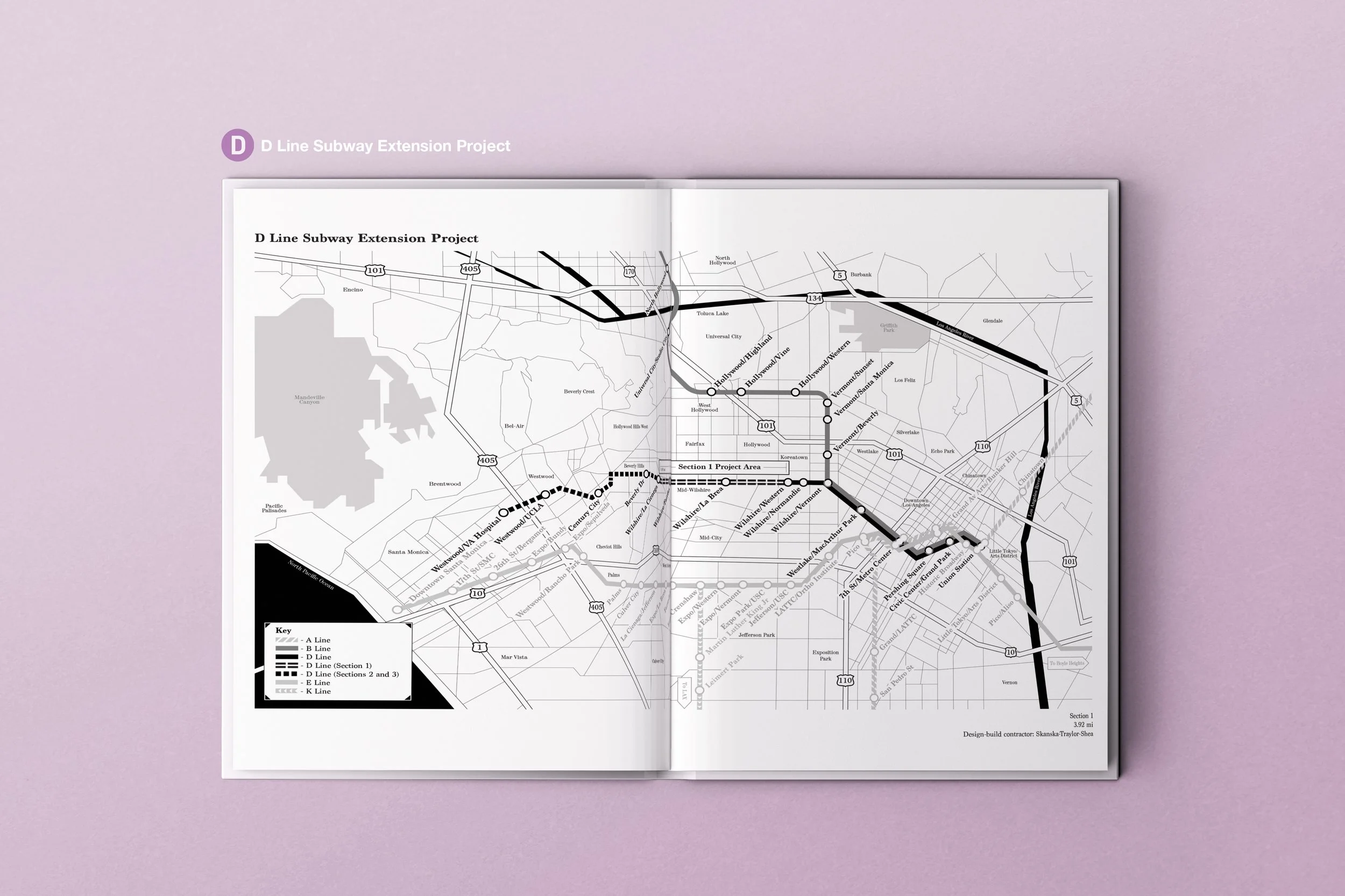
I had the privilege of creating the D Line’s map Illustration for a black and white photography book, ‘Wilshire Subway: The Making of the D Line Subway Extension’ By India Mandelkern and Photography by Ken Karagozian. This book details the history of the subway build to the present day opening of the D Line Subway Extension, a 3.92 mile stretch from Wilshire Blvd to La Cienaga. This map took several iterations with the combination of about 9 maps to create an accurate portrayal of the subway stops as well as neighboring cities of the LA area.
India had a vision for this map to be grayscale to compliment Ken’s wonderful industrial black and white photography that is the focal point of the book. The first iteration only included the D Line itself, but had evolved into a two-page spread that was complex and sprawling to include other subway lines. As located in the key, the map is also separated in 3 sections to better help readers visualize the construction and progress of the subway build.